Cyclone Jawad Update(04-12-2021)
Category : Politics & Social | Sub Category : Social Posted on 2021-12-04 03:39:51
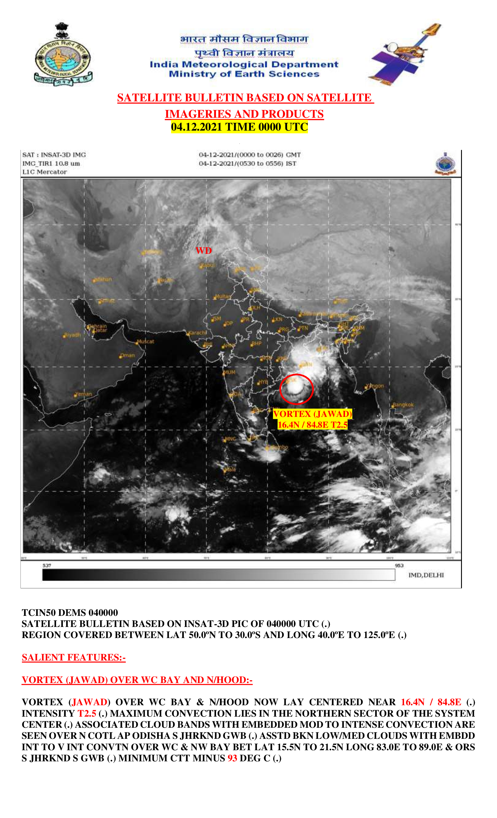
Cyclone Jawad is likely to reach off north Andhra Pradesh and Odisha coasts by Saturday morning after the deep depression intensified into a cyclonic storm on Friday noon. The Indian Meteorological Department has predicted rainfall to pick up the intensity on December 4 as Cyclone Jawad moves along the coast to make landfall the next day near Odisha’s Puri. After a pre-cyclone watch was issued on December 1, the Met department issued alerts related to heavy rain and high wind speed for Andhra Pradesh, Odisha and Gangetic Plains of West Bengal and some northeastern states.
Odisha and Andhra Pradesh are expected to witness the maximum impact of Cyclone Jawad as the squally wind that started along and off north Andhra Pradesh and Odisha coasts on the intervening night of December 3-4 is likely to reach up to 7–80 kmph gusting to 90 kmph by Saturday evening.
On Saturday, heavy to very heavy rainfall at a few places and isolated extremely heavy rainfall is likely over north coastal Andhra Pradesh. IMD has issued a red alert for Visakhapatnam, Srikakulam and Vizianagaram in view of heavy rainfall along with high wind speed.
A few places over coastal Odisha is expected to receive heavy to very heavy rainfall while isolated places in the region are expected to receive extremely heavy rainfall. Isolated places over West Bengal are also likely to receive heavy to heavy rainfall as Cyclone Jawad changes the route to move north-northeastward.
Search


Categories
Recent News
- Future Network-5G
- Most downloaded apps in the World
- Internet of Things Role in Building Smart Cities
- Technology role in shaping the future World
- Online Teaching and Learning tools suggested by UNESCO
- Technology Role in Shaping the Future of Education
- The Coronavirus Explained, and What You Should Do
- Aarogya Setu -app launched by Govt. of INDIA to fight against COVID-19